Mending the Blanket

This is a selection of drawings about the restoration of blanket bog. Peat ‘hags’ are a feature of badly eroded peatland, but they can be re-profiled to allow new growth of wetland mosses. Peat from a restoration programme at Crunklie Moss in the Southern Uplands was used to make the drawings shown in this post.


Mtb jpegs.002

I am working on a series of drawings about the restoration of Crunklie Moss,  which lies in a remote valley called Gameshope in the Scottish Southern Uplands. Gameshope is a former sheep farm which is coverd by ‘blanket bog’ – typical for this area. Borders Forest Trust now own Gameshope and want to restore the eroded peatbog. Tweed Forum is doing this through Scotland’s Peatland Action programme.

This is a selection from work in progress, which is made in appreciation of the work of people who are making peatland restoration happen on the ground. Rachel Coyle (Peatland Action Project Officer based at Tweed Forum) and Kenny Veitch (Drumclog Plant) worked on Crunklie Moss in early 2019 and helped me find some ‘squagy’ peat.

Squagy peat is the sort of peat that is good for creating peat-dams – and also perfect for making prints on paper.


Mtb jpegs.005

Mtb jpegs.006

Mtb jpegs.007

Mtb jpegs.008


Mtb jpegs.010


Mtb jpegs.013


Acknowledgements to Peatland Action, Tweed Forum, Drumclog Plant, Borders Forest Trust, Crichton Carbon Centre, and Galloway Glens Landscape Partnership for support during the development of this piece.


River Ways and Land Uses

A drawing, a map and a guide are connected by the flow of water in the Tweed tributaries.

Kate Foster PC Mtb.002

This is soon to be published as a pecha kucha talk . It is about a catchment drawing, a Land Use map, and a guide to how carbon moves for water to air. The connecting theme is the flow of water in the Tweed tributaries. To begin, here are some of their names, collated for a project I was part of, “Working the Tweed” (2013)Kate Foster PC Mtb.003

Catchment maps are handy things for a project to have, but we needed one that was affordable. So I traced these River Ways to make a talking point on our project stall at agricultural shows. The drawing became a project motif. The Tweed is a very dendritic river – this drawing leaves out fine detail.

Kate Foster PC Mtb.004

This slide gives an impression of the project Working the Tweed. The Borders region is defined and connected by rivers, though people often think of it in terms of its towns. We learned that many people know their River Ways really well (and could point out  inaccuracies).

Kate Foster PC Mtb.005

Of course, many other artists have been inspired by The Tweed – these are just three that I have followed. Helen Douglas’ sumptuous bookwork Follow the River developed in the Yarrow Valley ; the Tweed Rivers Interpretation Project; and Andrew Mackenzie as project artist with the Hawick Flood Protection scheme.

Kate Foster PC Mtb.006


Here is Jules’ Horne’s Tweed Tweed made in cloth. It adapts an engineers plan for a re-meandering project at Eddlestone Water (near Peebles). These works were led by Tweed Forum. We showed this work with a toy-digger so people of all ages could help make the river meander again.

Kate Foster PC Mtb.007

At some point, I realised I should think about Drains too. People have been building a second kind of catchment over the centuries, rushing water to the sea. I began to look for drains in the landscape, and get interested in Subsurface drainage patterns.

Kate Foster PC Mtb.008

I also have become slightly obsessed by diggers (perhaps I’m not the only one). You see them everywhere when you start looking – performing Landscape Service and doing plenty of Groundwork. But they do seem to hide when it comes to Landscape painting and photography.


Kate Foster PC Mtb.009


Through the Tweed project, I and the other lead artists became involved in Pilot Land Use Strategy in the Borders, led by Tweed Forum as part of Scottish Climate Change Legislation. The consultation process focussed on maps and was framed by the concept of ecosystem services. The technical language of ecosystem services can be daunting …

Kate Foster PC Mtb.010

… but every person and every creature is affected by how humans use land. There’s various ways artists’ can contribute ‘intangible values’ and ‘cultural meanings’. As a starter, here’s the Tweed’s ‘indicator species’ – including salmon who need to migrate to cold Arctic waters.

Kate Foster PC Mtb.011

Stone Flies are a favourite food for salmon. Improvisational dancers also paid attention to their midsummer emergence on the riverbank. Stone Lives – led by Claire Pençak – developed as a result. This includes a dance score about personal associations with what happens in particular places.

Kate Foster PC Mtb.012

The 1930s Land Utilisation map is in the Mapping the Borders exhibition – it is still in copyright. Here’s a hint of what it looks like. This sketch was an experiment in using Claire’s score. The Land Use map itself is very colourful indeed, with yellow uplands of moorland and heath and flowing towards brown and green valleys, and red or purple towns.

Kate Foster PC Mtb.013

The 1930s map gives bright colours to times I have otherwise glimpsed through black and white photos. I imagine walking in these uplands then – curlew cries, shepherd’s calls, dark skies with crisp cold autumns … but perhaps the colours add gloss to what were hard ways of living.

Kate Foster PC Mtb.014

So, next, this is a scientific instrument – a Flux Chamber that measures how much carbon dioxide is released into the air from a flowing river. The amount of carbon being released as gas depends on the time of day, what season it is, and how the land is being used. Flux Chamber became the title for an interdisciplinary project about carbon landscapes.

Kate Foster PC Mtb.015

You cannot sense directly when carbon is moving fast from water to air, but you can learn to read signs of when it is likely – when the river is turbulent, brown and noisy. I piloted a ‘guide’ to carbon landscapes with a biogeochemist and a scholar of environmental literature.

Kate Foster PC Mtb.016

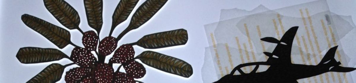
You can see this guide at the exhibition. It opens with an invitation: think of the lines on a catchment map as places where carbon is being released into the atmosphere. This piece combines Susan Waldron’s scientific observations with poetic responses by David Borthwick, and my drawings.

Kate Foster PC Mtb.017

Animal life plays a role too. Caddis flies –  like Stone Flies,  need clean waters and live in fast flowing upland streams. Expressed as poetry by David Borthwick:
.. the caddisfly larva (shredder, scraper, collector)
makes an armoured harbour
a tiny sequestration
sealed for instar
pupation for take off

Kate Foster PC Mtb.018

Another of the six pages is about Water Colours:
‘ soil and inorganic carbon colours the water and is swept downstream, which increases the flux from water into air. So the intensity of the colour of the water gives a clue about how much carbon efflux is happening.’ (Susan Waldron)

Kate Foster PC Mtb.019

These are colours of clear water of the upland River Yarrow, drawn out by the sun. The range of colours appeal to the senses, more alluring perhaps than after heavy rainfall when the river becomes dark brown.

Kate Foster PC Mtb.020

You can’t feel a river shedding carbon directly, but we can watch the leaf-fall onto its surface. We can see leaves snagged on trees at the river bank, left by previous torrents. Through drawing, I find meanings of a specific place which are not expressed by technical reports. For example, this next drawing about how autumnal leaves move in a swirling current.

Kate Foster PC Mtb.021

With winter rains, the rivers will become torrential, opaque brown with silt. I find this sight compelling and formidable.

The fears, hopes and meanings I find in places keep shifting around the metrics of mapping and surveys.

Rift Valley flyway

A road trip from Israel’s southernmost town of Eilat to its northernmost village of Metula offered glimpses of birds negotiating natural and human-made hazards. Birds can fly over the security fences that now entirely surround Israel, but on their passage they depend on the ways people use land to get safe roosting and forage.

The Rift Valley, running south to north through Israel and the Palestinian Territories, pulses each spring and autumn with millions of birds migrating between Africa and Europe.

Eilat is Israel’s southernmost town, very close to the Egyptian and Jordanian borders. At the end of March, thousands of Steppe Buzzards roosted on the ground overnight in the hills above the town. As the morning heat gathered, the birds rose upwards in the thermals.

eilat3-1web

A group of Artists for Nature were working at a viewpoint. The guides pointed out that Black Kites, Ospreys, White Storks, Steppe Eagles were some of the species that were flying alongside the buzzards.

Looking into a patch of blue sky through binoculars, you could see raptors appear in spirals and then disappear in high northward streams.


eilat8web

The new Security Fence could also be seen on the Egyptian border, with an observation post on the mountainous skyline.

With just a naked eye in such a sweeping landscape, the effort of the birds to reach the sky could only be seen as minute moving pinpoints.

eilat6web

Below the viewpoint, the expanding desert town of Eilat sits in the small triangle of land between Egypt and Jordan. A string of luxury hotels now greets tourists who can fly in.

redseahotels

Travelling north to the Negev desert, the road passes an airport under construction. The new Ramon airport will allow the largest of airplanes to taxi and turn, and will also release land nearer the town for more hotel development.  A peace-making plan for Israel and Jordan to share an airport was abandoned, so there are two airports next to each other on either side of the border.

negev2

Further north an oasis in the Negev provided delightful Organic Dates. I felt the ground shudder: ordnance, I assumed.

negev1

Dried-out ground stretches across the valley towards Jordan at the southern edge of the Dead Sea. This is the consequence of water and potash extraction.

To date, the Dead Sea has already lost over 1/3 of its surface area, the sea level has fallen over 25 meters and is continuing to drop by over 1 meter per year, causing land-subsidence sinkholes and other irreversible damages.

Quote: http://ecopeaceme.org/projects/dead-sea/

deadsearoad3

The rapidly increasing scale of human activity was underlined by comparing a 60-year old photo of the road along the Dead Sea (shown in Ein Gedi Kibbutz), with a snap from our car window.

deadsearoad

deadsearaod2.jpg

A lay-by on the road offers a viewing point for Lot’s Wife, a Biblical character. Her name may not be remembered, but her form still stands in the intensely folded rocks.

lotswife1

A resident Raven flew above the precipice. In the desiccating atmosphere, watercolour paint was dry by the end of a stroke.


lotswife2

On the road north to Galilee, flecks in the sky turned out to be a flock of White Storks looking for an overnight roost.

galil

Past Lake Tiberias, a road climbs into the hills above the Hula Valley and overlooks what was once an extensive wetland.

Before being drained in the 1950s, the original lake and surrounding extensive marshes were the largest wetland habitat in the Middle East. Since the draining, there has been a slow but steady push to restore wetland habitats, including the Hula Nature Reserve and the Agamon Lake. Today these wetlands, along with the surrounding agriculture and native woodland hillsides, attract the greatest diversity and abundance of wildlife and birds found along the northern Great Rift Valley, among which are over 60 globally threatened plant and animal species. Much of this diversity is directly related to the site’s location at the crossroads of Eurasia and Africa, where several bioregions overlap.

Source:  http://www.artistsfornature.com/projects/the-hula-valley/

hula1

Israel’s northernmost village of Metula is next to the disputed territory of the Golan Heights. Intensely farmed fields characterise the views towards Syria. Looking towards Lebanon, the skylines are truncated by roads and an intensely patrolled border but hint at remains of beautiful forests.

lebanonborder

metula1

Around Metula, there were orchards of all kinds – vines, apples, apricots, chestnuts.

metula2

Nahal ‘Iyyon Nature Reserve   boasted an extraordinary variety of wild flowers.

metula4

In the hills, White Storks were using the edgelands of Tsfat town rubbish dump for roosting and forage. Lines of storks dodged the compactor as it moved across the site, with shuffling jumps. Groups of storks then began to form and fly upwards with the morning heat. Birds in their hundreds, in their thousands – all moving north.

tsfat

Birdlife International is working to protect this international flyway.  One conservation aim is to prevent of illegal trapping and hunting of birds in passage, especially the small songbirds. In this context, the welfare and free movement of birds and people become interdependent ideas, and human and avian culture inseparable.

Looking back through my sketchbook, these glimpses of migrating birds in such numbers and variety emerge as an intangible memory.

eilat9

reflections on place drawing and relational thinking

Collaborative drawing at Purton Boat Graveyard led us to reflect on conventions of wildlife representation, and how relationships between species and place might be drawn out differently.

purton5w
Severn Estuary from Purton Boat Graveyard (image Kate Foster)

This post is jointly written by Jethro Brice, John Fanshawe, and Kate Foster

At Purton Boat Graveyard an assortment of disused river craft were buried over the years to protect the eroding shoreline of the River Severn. Jethro Brice suggested this site as somewhere to continue experiments in shared drawing of place.

Arriving at high tide, we watched the mass of the muddy estuary water drop astoundingly fast. The wind was blowing hard upstream, and patches of sun ripped across the estuary.

We talked about what we aspire to do, through drawing. John Fanshawe has proposed ‘biocultural drawing’ to describe bringing biological and cultural aspects together on the page, in order to mine a sense of place.

purtongblog
Image: John Fanshawe

John’s conservation work with BirdLife International includes reflection on the relationships between species loss and how that relates to the extinction of experience. Jethro’s PhD research aims to draw multispecies wetland narratives, and open spaces of encounter at different levels, between human and non-human cultures and between disciplines. Kate uses drawing to investigate relationships, focusing on particular vignettes of environmental change and drawing out questions of scale. She draws as a path to reflective observation, making links to what is happening over time and in different places. With Michael van Beinum, we reflected on how – individually and collectively – we might find structures to keep our exploration of places through drawing an open process.

purdonjW
Drawing by Jethro Brice, in situ

Layering suggested itself as a initial theme, and Jethro’s warm-up solo drawings combined mud, masking fluid, and pen to convey weathered boat hulls. Kate considered the circular growth of lichen on the hulks, the horizontal movement of the tide and wind, and the rapid vertical drop of the water surface measured against a boat’s rudder. John explored how the movement of the wind – through both the riverside vegetation – and the falling tide animates drawings.

Purton 6 72dpi
Drawing by Kate Foster

We settled on a structure of shared drawing, with successive five minute attention to line, wash, colour and texture, before passing the drawings on. We all used the same media, preselected to suit the damp setting (wax pencils, water brush, ink and mud) and hoped that the rain might do some of the work.

Some shared drawings are shown below.

Time and weather put a dampener on further experiments.

With cups of tea and shelter, we considered why wildlife drawings (that can become bird portraits fixed in space and habitat) do not always satisfy our viewpoints from both conservation and the environmental humanities?

FullSizeRender

We reflected that our perspectives demand that any species is better understood in relation – as a constellation of complex relationships in time and space. It is possible to admire wildlife imagery when it is a triumph of technique combined with observation. However, when such drawing reaffirms a harmonious world, it could also serve to distract and obscure. If we find that through drawing, we distance ourselves from the non human world and objectify it, this runs the risk of reinforcing the idea that nature and culture are separate.  So our discussions focussed on avoiding this dualistic separation, and how we might try to make our drawing more relational and embedded.

Looking at nature or landscape in terms of relationships requires exploration of how of how what we are observing is shaped through human activity, both our own and that of others. The shorebird species, Bar-tailed Godwit is an example of how a relational approach helps. Research into its migration has had practical implications for joining up the links in a global conservation movement.  Bar-tailed Godwits are migrating earlier because of changes in mowing regimes in the Netherlands, and arriving early in West Africa where they can damage young rice crops. As a result, women are forced to walk long distances and grow lower yields of rice in the rainforest.  Just knowing the godwits as a species overlooks a complex constellation of shifting relationships, all of which are critical to understanding the needs of the birds and the people with which they interact along a flyway. But it remains the case that seeing a species as a discrete taxonomic unit is the prevalent way of learning about and representing most birds.

So, what can we do, in terms of drawing or strategies, to keep in mind the possibilities of shifting relationships, and make them more visible? A group, just as much as an individual, can get stuck. The drawing we aspire to in our shared sessions seems to be a strategy to force thought, to keep our affective responses lively, and to use the page as a tool to prompt reflection and conversation. Paper as a medium has strengths, being portable and cheap, but what other media and modes can we combine?

In our next session, we might return to images repeatedly, or work in rotation on different subjects. We may try different ways of using words – both as prompts and as responses.


place drawing as a shared process

Three days of field-drawing in the Scottish Borders let Jethro Brice, John Fanshawe and Kate Foster develop a method of shared drawing that helped weave individual observations with each other’s expertise.

Three days of field-work in the Scottish Borders let Jethro Brice,  John Fanshawe and myself find ways to share investigations of particular places. Preferring to work collaboratively,  we developed a method of shared drawing that let us weave our individual observations with each other’s expertise.

Accompanied by umbrellas, waterproofs, sketchbooks and numerous pencils, we went to three different places in the Scottish Borders. The first was Whitlaw Moss, a SSSI near Selkirk which is marvellously categorised as being a very wet mire likely to have an unstable ‘quaking’ surface. Access to the Moss is restricted – my view of it had up till then been from a car window on the road above. Getting close-up, a wonderful variety of plant and insect life came into view.

How could we possibly represent this? Grasses, sedges, orchids, ragged robin, moths, beetles…

ragged-robin
Close-up of Whitlaw Moss (image Kate Foster)

Attempting to draw generated further unsteadiness – my A3 sketchbook pages flicked over with impatient speed.

oats
A quaking oat stilled on the page (image Kate Foster)

I found this self-imposed flat rectangular format frustrating, and also the sedentary character of plein air drawing.

I considered swimming in a ‘well-eye’, and admired bogbean.

welleye
Photo: Kate Foster


bogbean
Drawing: Bogbean and welleye,  Kate Foster


In truth, we left somewhat frustrated with our attempts, and wondered where to go with this. Pursuing the model of individual artist in landscape seemed to have led us to clamber into boxes of our own making.

IMG_6228
Drawing: Jethro Brice


How could we make more use of being in such places together? We began Day 2 with an exercise suggested by Claire Pençak: using three bamboo sticks to generate collaborative patterns of movement.

bamboo
Photo: Michael van Beinum

En route to St Abbs Head, we talked about two much-missed painters, John Busby and David Measures, who remain important influences for groups of artists committed to observational drawing of birds.  Measures and Busby  both found ways to express their unique voices – coaxing their students away from photographic styles of representation towards an exploration of movement and place. Few of us can hope to catch birds’ giz as Busby could, or look at their subjects with the commentary and dynamism that Measures achieved. What could we offer instead?

In different ways, we each work towards exploration of what can be termed ‘biocultural’, jargon for the goal of acknowledging people’s activities and concerns within more-than-human processes. Also, given contemporary complex and knotty environmental problems, we discussed how the process of making artwork must include the possibility that everything is not OK. A visit to St Abbs is imbued by a possibility that this year could be the last seabird summer – as Adam Nicholson investigated in a recent BBC programme.

The cliffs at St Abbs at St Abbs are hard to encapsulate, though Jethro found his efforts greatly freed up by the collaborative exercise:

stabbs3
Drawing: Jethro Brice

Listening together offered an additional pathway for exchange. We drew soundscapes by passing our sketchbooks round every 5 minutes, yielding these images:

stabbs1

stabbs4b

stabbsmap

Above: Shared drawings at St Abbs, by Jethro Brice, John Fanshawe, Kate Foster

We found this way of working to be constructive. John’s poetic and expert eye for movement and Jethro’s structural intelligence, in combination with my restlessness, let us make something different than we could achieve individually.

As ‘drawings’, the early marks on paper staked out composition and focus: we worked progressively to adjust tone, flow, and colour. As ‘conversations’, these shared works allowed us to see different aspects of each place we were in. We puzzled on problems, such as how sounds have shape and colour. Above all, this process helped articulate emotional and subjective responses – in St Abbs where loss can be felt vertiginously, and marvellous and terrifying elements beyond our control can be glimpsed.

The third day saw us walking on the glorious Southern Upland Way, to practice our method, but in less sublime conditions.

stile
Photo: Kate Foster

Sheltering behind a wall, flattish wetness became a shared drawing that included lark, curlew and snipe call.

stile1
Shared drawing on the Minchmoor by Jethro Brice, John Fanshawe, Kate Foster

In these ways, we succeeded in opening up spaces of encounter – and helped hone specific questions and possibilities.

What now? Perhaps this may extend beyond an interdisciplinary conversation, to engage further kinds of knowledge of place – tacit, instrumental, more than human?