A record of the Working the Tweed project

As there is continued interest in this 2013 project, we are making this presentation to German Friends of the Earth available for the record.

This presentation was given at the invitation of BUND (German Friends of the Earth) in October 2016 to their annual conference in Burg Lenzen, on the River Elbe.


BUND talk slides.001

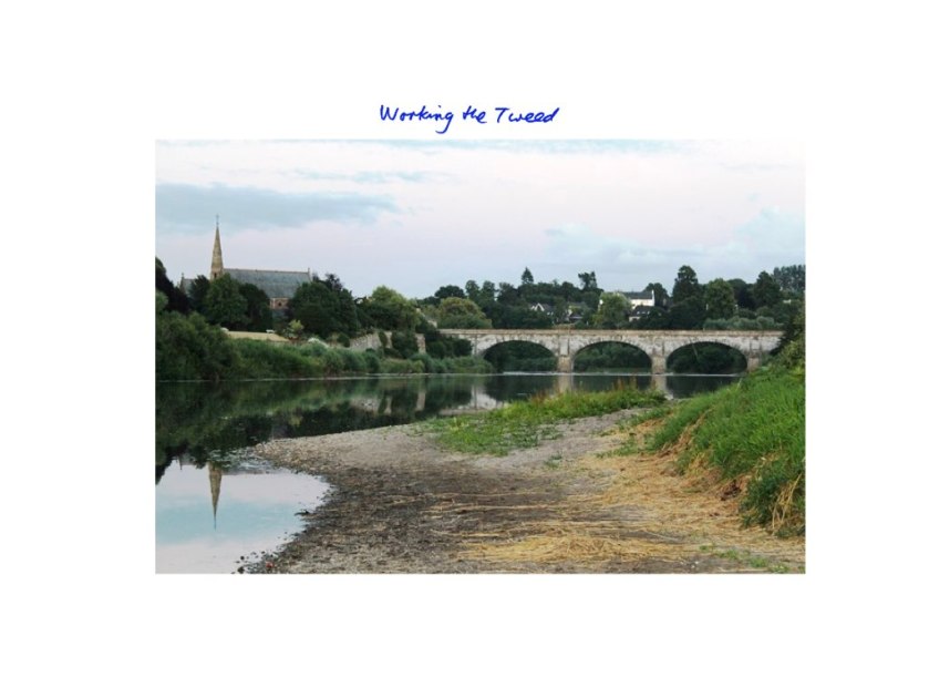
Working the Tweed was a socially engaged arts project in a rural region of Southern Scotland. Artists have led or been involved in similar projects elsewhere – and we hope the ways that artists can work is interesting for you with BUND’s work on the Elbe. This is offered as a pilot project for discussion, not as a finished artwork.

BUND talk slides.002

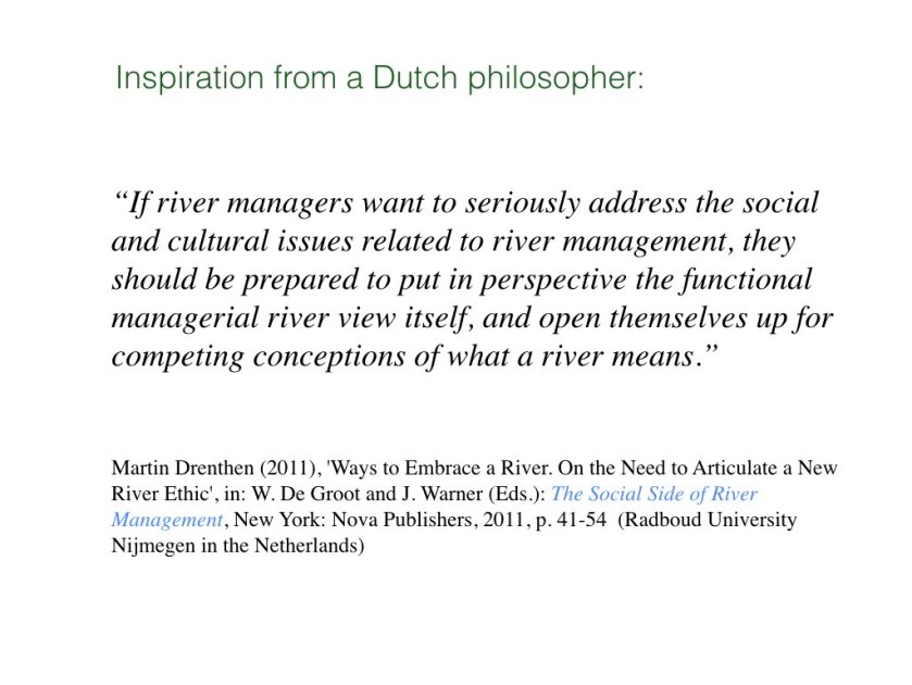
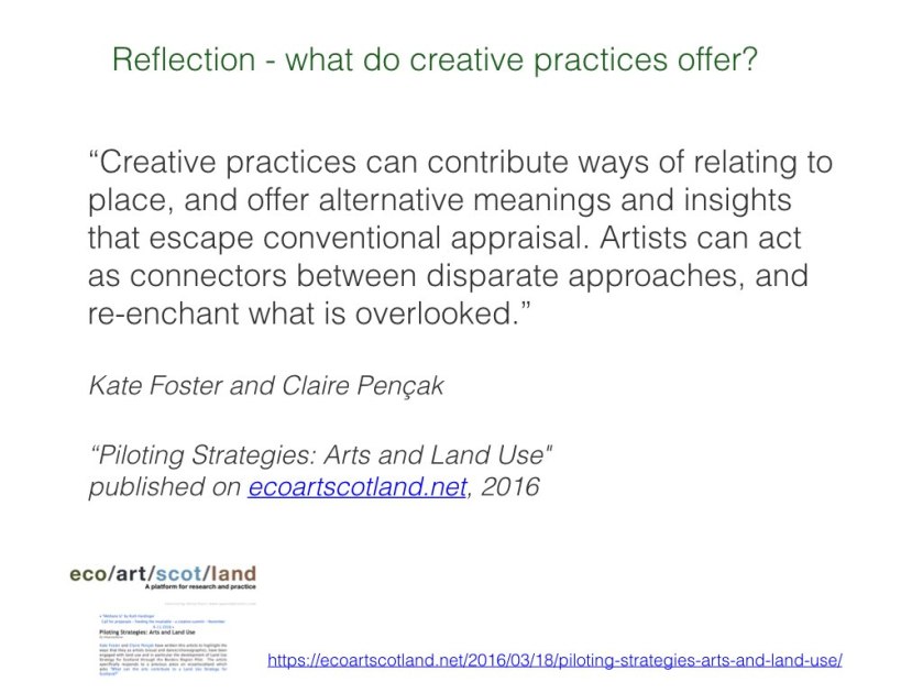
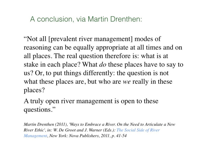
This quote neatly summarises what we hoped to do: to contribute to river culture. Martin Drenthen is a Dutch philosopher who has done considerable work on rivers, communities and place-making. We chose our project title to emphasise the livelihoods offered by the river: how people have managed, used, and shaped it, and how other species depend upon it. We offered our project as a resource for creative practitioners in our region. We also wanted to connect our partner agencies with people who see the river in less instrumental ways.

BUND talk slides.003

BUND talk slides.004

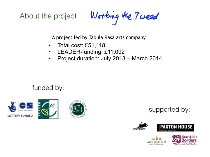
The project won public funding from the government arts and environmental agencies available via a ‘Themed’ year of Natural Scotland. Additional funding was via LEADER (EU), a charitable trust, and  support of regional venues.

BUND talk slides.005

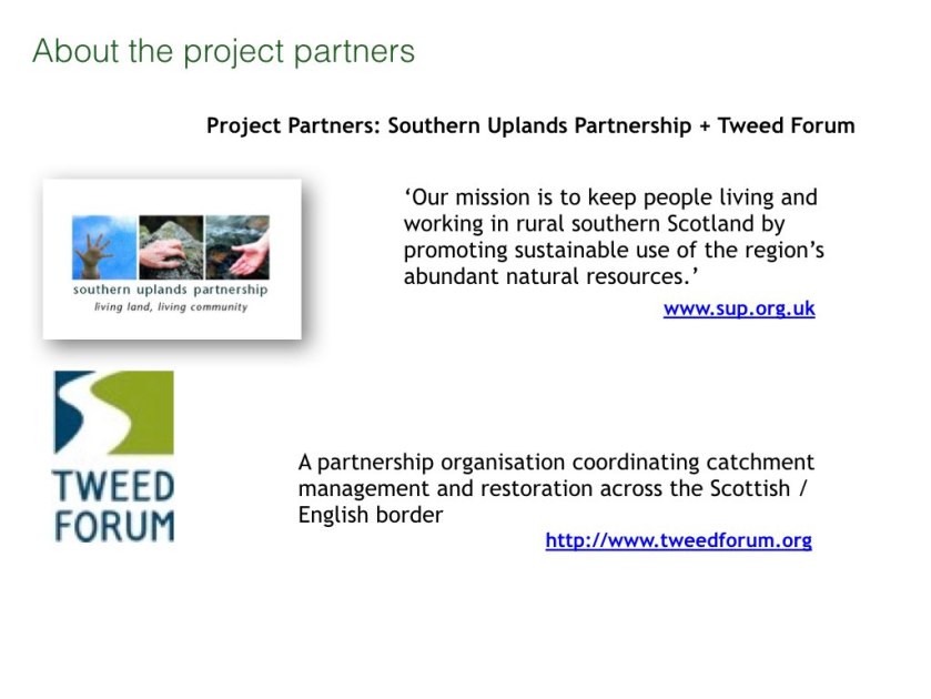
It was an artist-led project with partnership working at its core. We approached the two key agencies in our region concerned with sustainable development and environmental protection in the river catchment. Both are ‘bottom-up’ membership organisations.

BUND talk slides.006


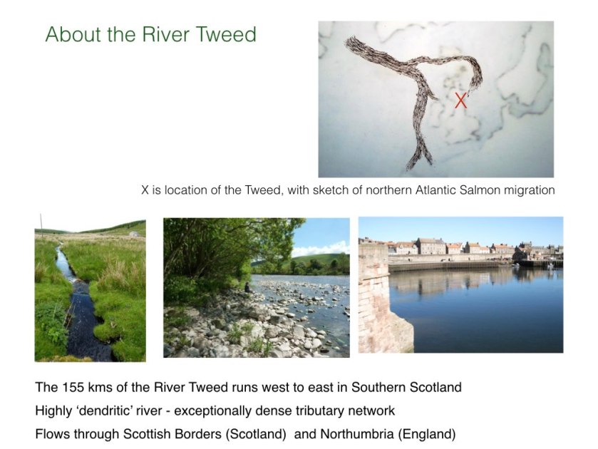
The Tweed River flows from upland moorlands towards richer agricultural lands, meeting the sea at Berwick upon Tweed. Its last section acts as a border with England. Salmon, trout, and other migratory fish run. Sport fishing is economically important.BUND talk slides.007

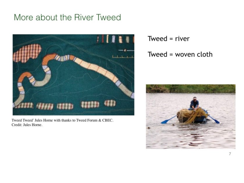
The River shares its name with woven cloth historically produced in the area’s small towns. The river was vital to an international trade as it powered the textile mills. The lower reaches were commercially fished. The Tweed has inspired many artists and is now seen as a rural river where nature can be enjoyed. There is a resurgence of interest in renewable hydropower as part of small town regeneration. Several flood protection schemes are being put in place.BUND talk slides.008

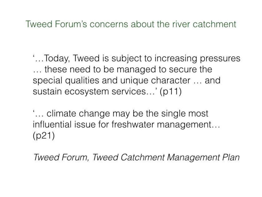
This is how Tweed Forum has summarised concerns about the river catchment. Tweed Forum’s Catchment Management Plan helped us structure the project. This adopts the concept of ecosystem services which can be given monetary value. As artists we were also concerned with intangible cultural value.

BUND talk slides.009

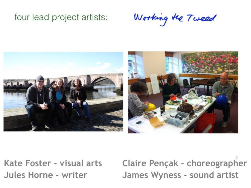
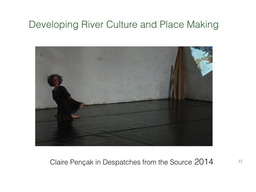
For this project we as artists abandoned the expectation of making individual works. Instead, our role was to use our skills to facilitate conversation, through Claire Pençak’s creative direction. Our different art-forms let us respond flexibly to different contexts.
We had to learn to understand and speak different ‘languages’.
It was a pilot project researching ways to approach future artwork. This project let us develop our own and others’ awareness of the river and build networks across the catchment.

BUND talk slides.010BUND talk slides.011

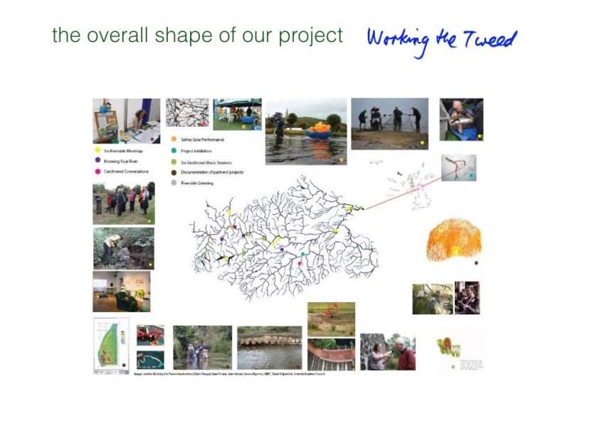
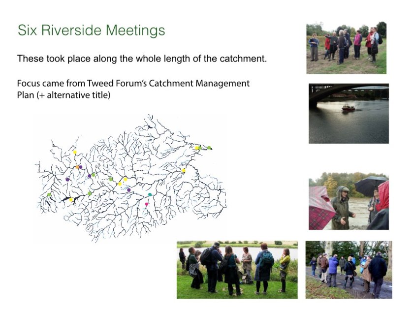
It consisted of many different forms of meeting in unconventional settings, developing the art of conversation around river issues. A copy of the poster is available here.

BUND talk slides.014

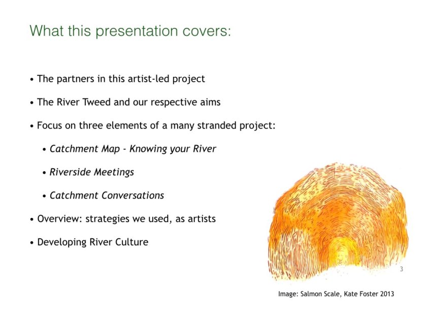
We will cover three of its eight strands: Knowing your River which toured public agricultural shows; the Riverside Meetings in carefully selected places and open to all interested artists; and Catchment Conversations which brought river specialists together for a concluding event. (The slide mentions the other strands).

BUND talk slides.013

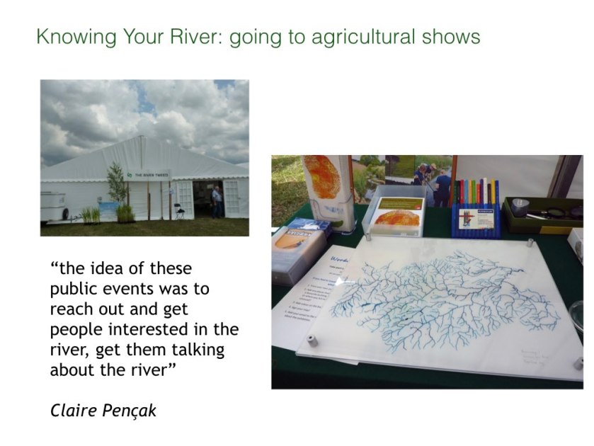
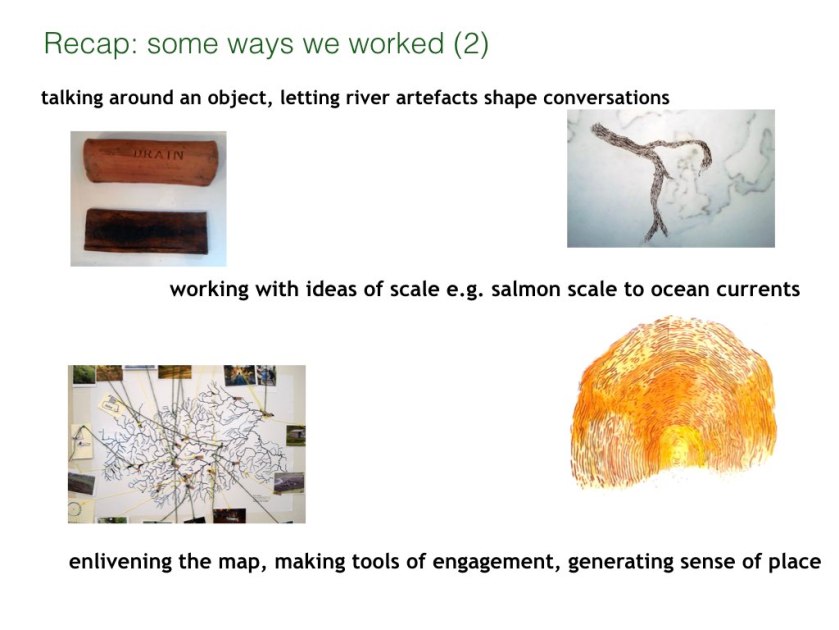
An accurate geographical catchment map is not freely publicly available, but we wanted one for the project. We created a traced drawing offered people a new view of their region. It does not show towns, or river names.

BUND talk slides.014

We took this map to agricultural shows – busy summer events in the region. We invited people to locate themselves according to the catchment map. This prompted conversations which revealed a depth of local knowledge and many different ways of knowing the river.

BUND talk slides.015

People were interested in this catchment image and it became a motif for the project. The idea of the region as a catchment – rather than a series of small towns with strong civic pride and rivalries – offered a sense of connectivity and cohesion.

BUND talk slides.016

Invitations to Riverside Meetings were circulated via arts networks. The meetings included informal talks by ecologists, botanists, hydrologists, land managers, curators, biologists, cultural leaders, environmental officers, countryside managers and rangers, ground workers and foresters.BUND talk slides.017

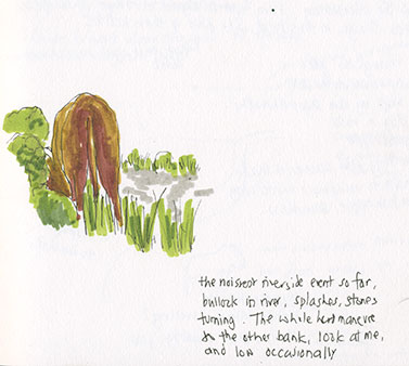
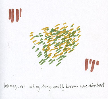
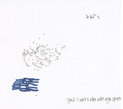
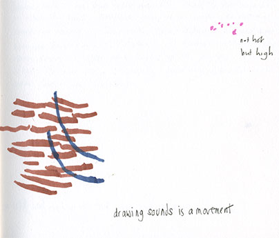
Habitat and Species (from Tweed Forum Catchment Management plan) had a parallel theme of More–than–human (a term from cultural geography). In this photo, an ecologist points out Otter spraints (poo) to a poet. The riverside meetings were informal – no power point! People met at the river and talked freely about their connection to it.

BUND talk slides.018

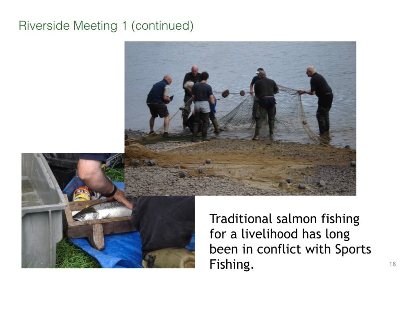
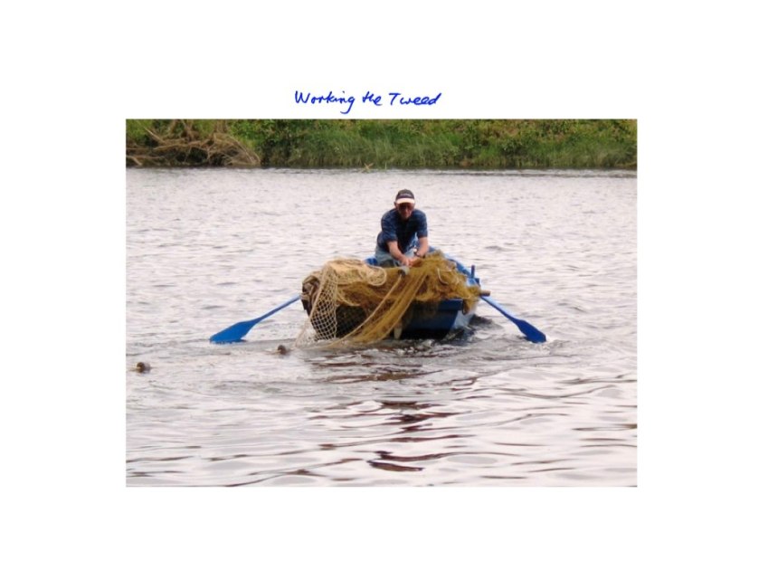
The site for this first meeting was a traditional fishing (Haaf) spot, the fishermen on this occasion were helping a biological survey by Tweed Foundation – an organisation that informs Sports Fishing which now is dominant. Tagging the Salmon gave the meeting a focus. The session ended with a boat trip to the river mouth.

BUND talk slides.019

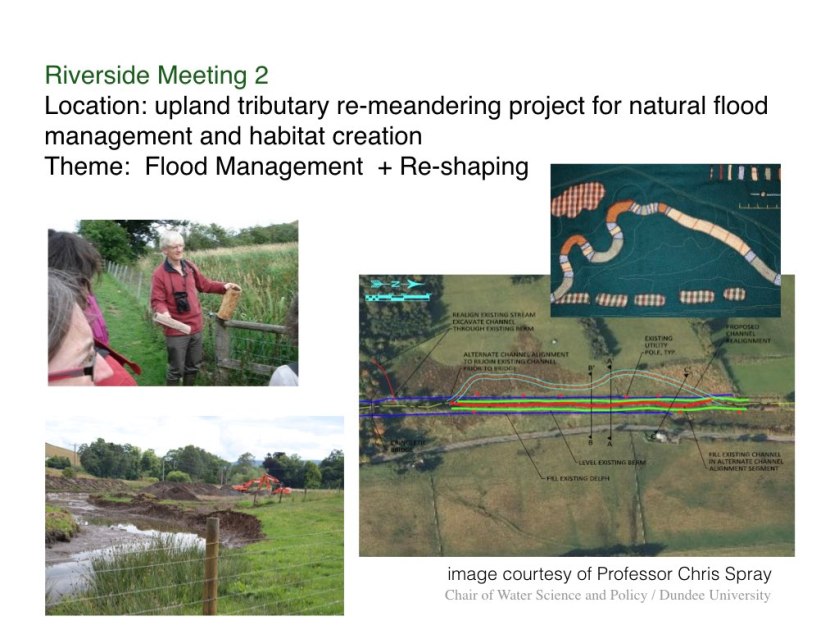
A hydrologist, Professor Chris Spray from Dundee University, described why historical drainage and river straightening had led to this stretch of river being graded poor by EU Water Directive Framework. We looked at the groundworks involved in re-meandering the river (which are now considered successful and are being extended).

BUND talk slides.019

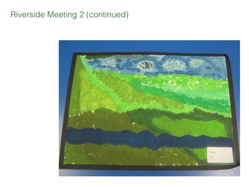
A local school teacher attended and later took a class to this site for a creative writing project on re-meandering.

BUND talk slides.020

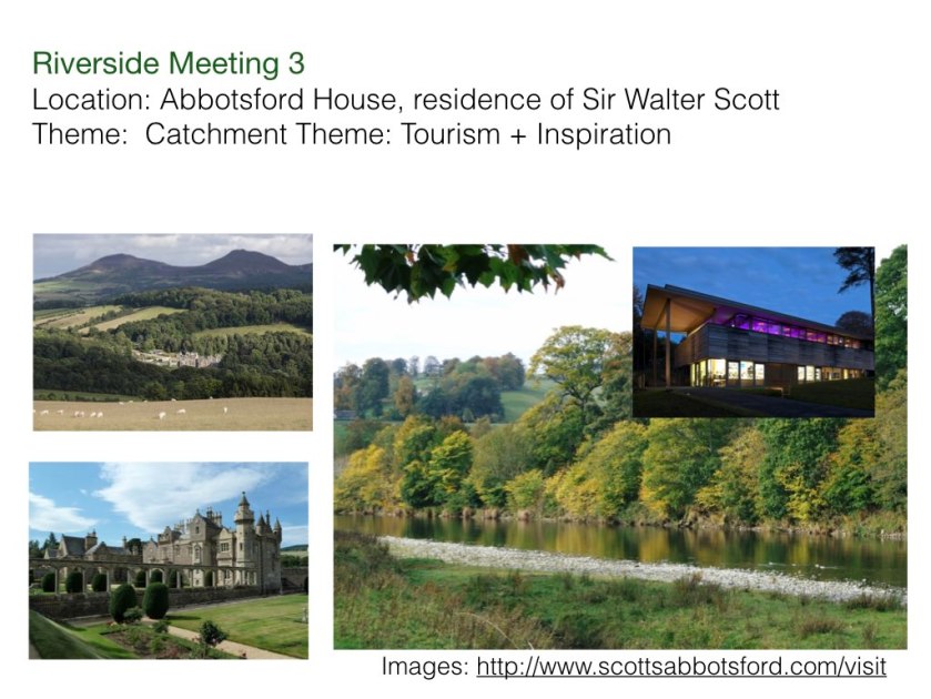
This was at Abbotsford House, culturally significant because it was the writer Walter Scott’s residence (an important figure in Scottish history).

BUND talk slides.021

Caulds were barriers originally created for industrial water power. This innovative renewable energy scheme was popular locally, and interesting to watch too. A fish pass was tailor-made for migrating fish, lamprey and eels (though people were not sure if this really worked) as well as salmon.

BUND talk slides.023

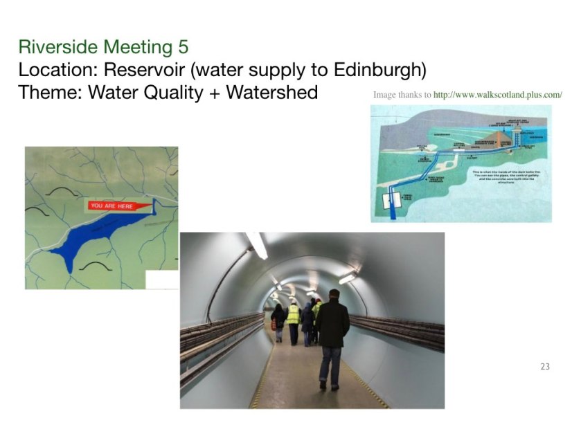
Megget Water is Reservoir in the uplands, built in the 1950s to supply water to Edinburgh. This is a protected site because of water security issues, and it was exciting to get access to this dam through our growing project network. Local people and environmental managers came along, who would not normally be permitted to go there.

BUND talk slides.024

We discussed the Government’s pilot Land Use Strategy (Climate Change Scotland Act) alongside the recent Scottish Borders Region Cultural Strategy. This drew out the topic of cultural landscapes, and the interconnection with culture and land use. We reflected on how short-term political cycles do not achieve sustainable management , and how local actions have impact elsewhere.
There is an account of our artwork in parallel to the Land Use strategy here.

BUND talk slides.025

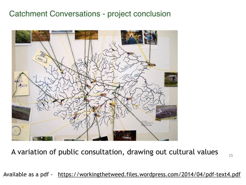
This was the culmination of the project, directing attention to the future and action. We offered this event to our partner agencies as a variant of public consultation.
This brought together ten people by invitation, with varied relationships to the river e.g. a scout leader keen to get young people canoeing, a development manager for community energy projects, and a forestry manager, a curator, and a digger driver. Many had been to a previous event.
 The venue was an inspiring furniture maker’s riverside studio – we decided not to use a standard conference centre. An arts setting can stimulate different ways of thinking.

The outcome was a brainstorm on what action to take on three key themes that had emerged through the morning session. Documentation is available as a pdf via http://www.workingthetweed.co.uk .

BUND talk slides.026

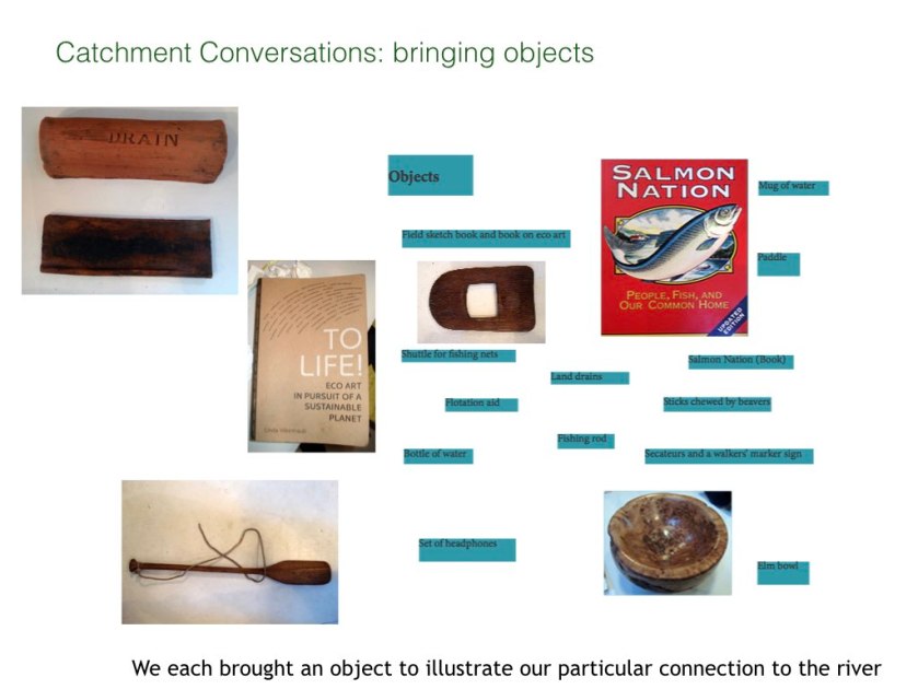
How did we structure this event? The morning session used objects people had brought to introduce ourselves in relation to the river. For example, a digger driver brought a collection of historical clay drains, one of which had a small hand print on it from the person who made it.

BUND talk slides.027

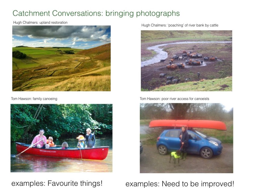
Participants also each brought two photographs, illustrating firstly something working well on the rivers and secondly something they thought needed improving.

BUND talk slides.028

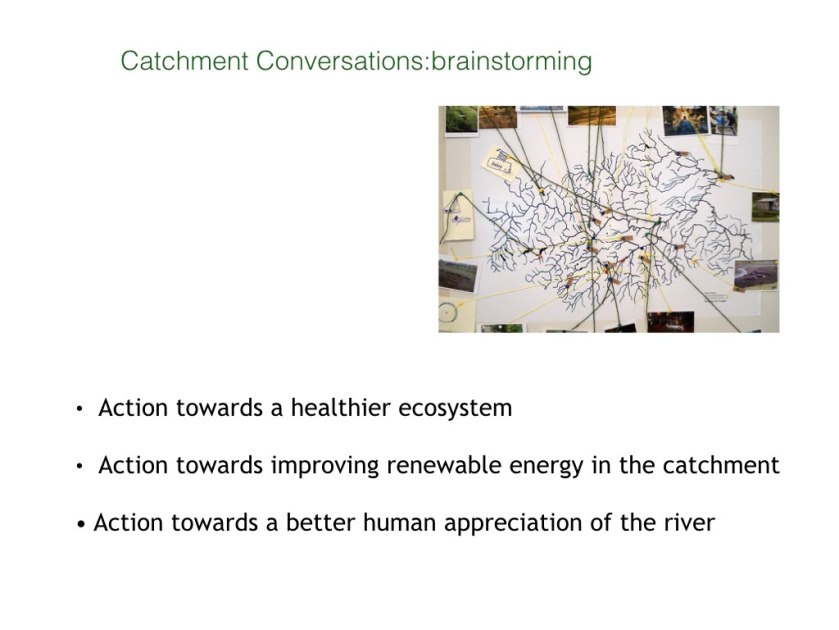
These are the themes for the afternoon workshop groups, themes that had emerged in the morning. We directed conversation to possible action. 
 This was a very different experience to going to a conventional meeting focussing on a specific problem (eg flood protection), like formal public consultation would do.

BUND talk slides.029

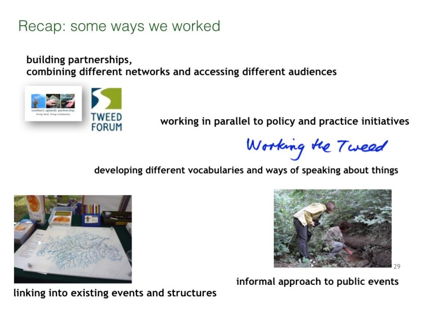
These two slides recap the strategies that we brought as artists to the design of the project. We needed to think laterally, develop symbolic language, make connections, network, use interdisciplinarity (requiring many meetings between lead artists).

BUND talk slides.030

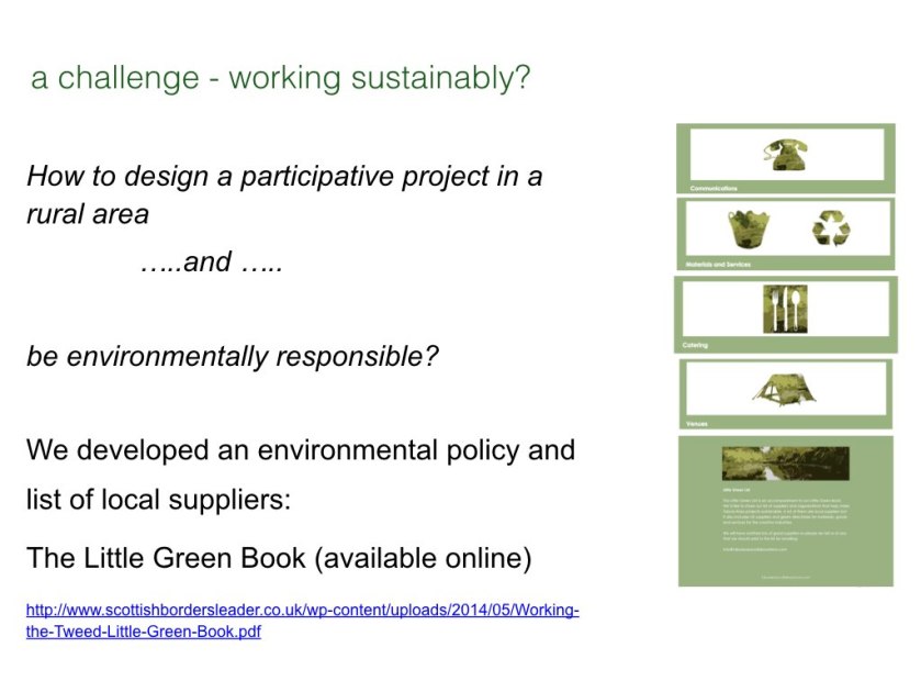
There are potential conflicts between generating participation in cultural activities and being an environmentally responsible organisation.
We aimed to conduct the project sustainably – eg use of materials, or providing shared minibus transport to riverside meetings to minimise use of private car.

BUND talk slides.031


Our intention was to take complex issues ‘off the page’ and into people’s imagination.
These are the material ways we communicated about the project to different audiences – from face to face, exhibition, to digital media. We made a DVD as a project summary, with reflection about collaborative practice and how arts practitioners can contribute to shaping the future of the catchment.

BUND talk slides.033

The digital element has given the project an afterlife, as a library for reference and an international platform. For example a sound map was developed through Aporee as a digital means to post interviews, music, and sounds of places where they were recorded.

BUND talk slides.034

BUND talk slides.035


BUND talk slides.037

BUND talk slides.036

Working the Tweed went some way to persuade funders, land use mangers and artists what creative practices can contribute to thinking around land use and environmental issues. It helped us appreciate that River Culture already strongly exists in our region, and think of further ways to get involved and help develop river connected projects.

BUND talk slides.038
!

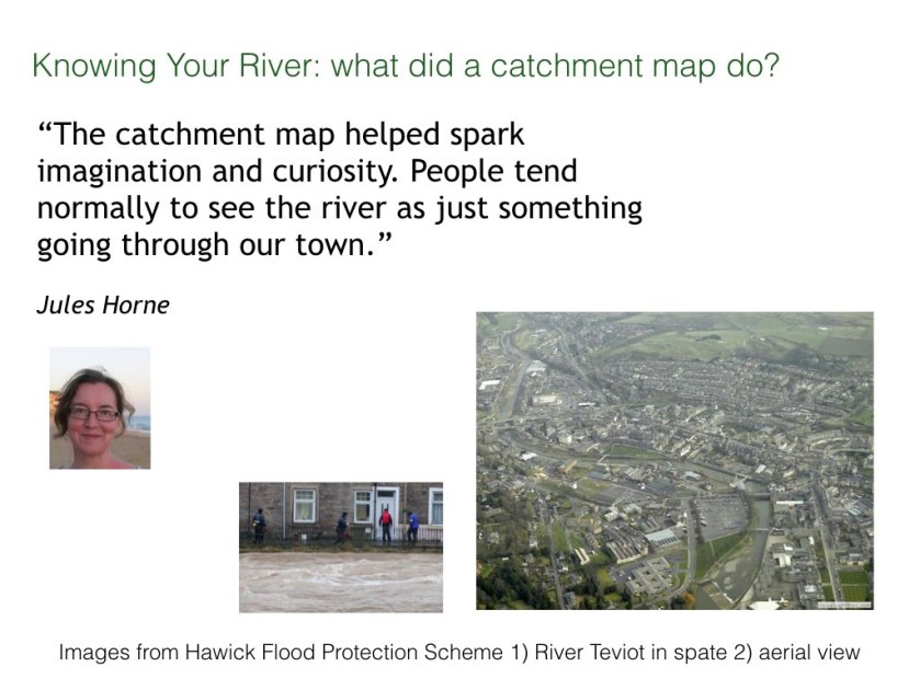
This project introduced a practice of including artists as part of teams working towards rural development projects, for example as a project artist for the Hawick flood protection schemes. Andrew Mackenzie became involved in public engagement and contributing to scheme design.

BUND talk slides.040

Thank you!

River Ways and Land Uses

A drawing, a map and a guide are connected by the flow of water in the Tweed tributaries.

Kate Foster PC Mtb.002

This is soon to be published as a pecha kucha talk . It is about a catchment drawing, a Land Use map, and a guide to how carbon moves for water to air. The connecting theme is the flow of water in the Tweed tributaries. To begin, here are some of their names, collated for a project I was part of, “Working the Tweed” (2013)Kate Foster PC Mtb.003

Catchment maps are handy things for a project to have, but we needed one that was affordable. So I traced these River Ways to make a talking point on our project stall at agricultural shows. The drawing became a project motif. The Tweed is a very dendritic river – this drawing leaves out fine detail.

Kate Foster PC Mtb.004

This slide gives an impression of the project Working the Tweed. The Borders region is defined and connected by rivers, though people often think of it in terms of its towns. We learned that many people know their River Ways really well (and could point out  inaccuracies).

Kate Foster PC Mtb.005

Of course, many other artists have been inspired by The Tweed – these are just three that I have followed. Helen Douglas’ sumptuous bookwork Follow the River developed in the Yarrow Valley ; the Tweed Rivers Interpretation Project; and Andrew Mackenzie as project artist with the Hawick Flood Protection scheme.

Kate Foster PC Mtb.006


Here is Jules’ Horne’s Tweed Tweed made in cloth. It adapts an engineers plan for a re-meandering project at Eddlestone Water (near Peebles). These works were led by Tweed Forum. We showed this work with a toy-digger so people of all ages could help make the river meander again.

Kate Foster PC Mtb.007

At some point, I realised I should think about Drains too. People have been building a second kind of catchment over the centuries, rushing water to the sea. I began to look for drains in the landscape, and get interested in Subsurface drainage patterns.

Kate Foster PC Mtb.008

I also have become slightly obsessed by diggers (perhaps I’m not the only one). You see them everywhere when you start looking – performing Landscape Service and doing plenty of Groundwork. But they do seem to hide when it comes to Landscape painting and photography.


Kate Foster PC Mtb.009


Through the Tweed project, I and the other lead artists became involved in Pilot Land Use Strategy in the Borders, led by Tweed Forum as part of Scottish Climate Change Legislation. The consultation process focussed on maps and was framed by the concept of ecosystem services. The technical language of ecosystem services can be daunting …

Kate Foster PC Mtb.010

… but every person and every creature is affected by how humans use land. There’s various ways artists’ can contribute ‘intangible values’ and ‘cultural meanings’. As a starter, here’s the Tweed’s ‘indicator species’ – including salmon who need to migrate to cold Arctic waters.

Kate Foster PC Mtb.011

Stone Flies are a favourite food for salmon. Improvisational dancers also paid attention to their midsummer emergence on the riverbank. Stone Lives – led by Claire Pençak – developed as a result. This includes a dance score about personal associations with what happens in particular places.

Kate Foster PC Mtb.012

The 1930s Land Utilisation map is in the Mapping the Borders exhibition – it is still in copyright. Here’s a hint of what it looks like. This sketch was an experiment in using Claire’s score. The Land Use map itself is very colourful indeed, with yellow uplands of moorland and heath and flowing towards brown and green valleys, and red or purple towns.

Kate Foster PC Mtb.013

The 1930s map gives bright colours to times I have otherwise glimpsed through black and white photos. I imagine walking in these uplands then – curlew cries, shepherd’s calls, dark skies with crisp cold autumns … but perhaps the colours add gloss to what were hard ways of living.

Kate Foster PC Mtb.014

So, next, this is a scientific instrument – a Flux Chamber that measures how much carbon dioxide is released into the air from a flowing river. The amount of carbon being released as gas depends on the time of day, what season it is, and how the land is being used. Flux Chamber became the title for an interdisciplinary project about carbon landscapes.

Kate Foster PC Mtb.015

You cannot sense directly when carbon is moving fast from water to air, but you can learn to read signs of when it is likely – when the river is turbulent, brown and noisy. I piloted a ‘guide’ to carbon landscapes with a biogeochemist and a scholar of environmental literature.

Kate Foster PC Mtb.016

You can see this guide at the exhibition. It opens with an invitation: think of the lines on a catchment map as places where carbon is being released into the atmosphere. This piece combines Susan Waldron’s scientific observations with poetic responses by David Borthwick, and my drawings.

Kate Foster PC Mtb.017

Animal life plays a role too. Caddis flies –  like Stone Flies,  need clean waters and live in fast flowing upland streams. Expressed as poetry by David Borthwick:
.. the caddisfly larva (shredder, scraper, collector)
makes an armoured harbour
a tiny sequestration
sealed for instar
pupation for take off

Kate Foster PC Mtb.018

Another of the six pages is about Water Colours:
‘ soil and inorganic carbon colours the water and is swept downstream, which increases the flux from water into air. So the intensity of the colour of the water gives a clue about how much carbon efflux is happening.’ (Susan Waldron)

Kate Foster PC Mtb.019

These are colours of clear water of the upland River Yarrow, drawn out by the sun. The range of colours appeal to the senses, more alluring perhaps than after heavy rainfall when the river becomes dark brown.

Kate Foster PC Mtb.020

You can’t feel a river shedding carbon directly, but we can watch the leaf-fall onto its surface. We can see leaves snagged on trees at the river bank, left by previous torrents. Through drawing, I find meanings of a specific place which are not expressed by technical reports. For example, this next drawing about how autumnal leaves move in a swirling current.

Kate Foster PC Mtb.021

With winter rains, the rivers will become torrential, opaque brown with silt. I find this sight compelling and formidable.

The fears, hopes and meanings I find in places keep shifting around the metrics of mapping and surveys.

Indicator Species

NY-2014-web
Tweed Creatures © Kate Foster 2013

The following was first posted on Working the Tweed as part of activities for Year of Natural Scotland 2013.

Ecologists have taken four species to act as indicators of the ecological health of the Tweed catchment: Salmon, Lamprey, Water Crowfoot and Otter. Conversations with specialists at Riverside Meetings prompted me to make a series of drawings. These were ink on perspex, and were shown in the project space at Harestanes last October.  Combined with field visits, making these drawings let me develop knowledge and become more observant. I now also understand these species better within my own life – as indications of time of year, of place, of change.

Water crowfoot

DSC05241

Detail from Indicator Species series © Kate Foster 2013

In summer Water Crowfoot (various species of Ranunculus – the buttercup family) can grow into great mats that include other plants. I learnt these are called ranunculion  – assemblages that can alter river flow and sedimentation pattern, sheltering the locality downstream. How had I never noticed them up till now?

I learnt the five species found in the Tweed Catchment have underwater leaves with varied branching patterns, examples below.

DSC05227

DSC05226

DSC05225

Details from Indicator Species series © Kate Foster 2013

These species show great plasticity – their form is very variable according to environmental conditions. Water Crowfoot readily hybridises, so its precise identification is complicated. I need to look closer to see patterns in ranunculion.

ranuncW

Photograph by Kate Foster 2013

Lamprey

Three types of Lamprey spawn in the rivers of the Tweed Catchment: Brook, River and Sea. The photo below shows electrofishing at a fish rescue by The Tweed Foundation and Tweed Forum at Eddleston Water in July 2013, where mature lamprey were found.

lampW

Photograph by Kate Foster 2013

Primitive jawless fish, that I had never before seen. Through google I learnt they sift microscopic organisms from silt in the riverbed in the larval form.

DSC05191

The larger two species (River and Sea Lamprey) mature and migrate to the estuary. They are parasitic and attach to fish to suck their flesh.

DSC05197

Detail from Indicator Species series © Kate Foster 2013

Each of the three species has its own characteristic mouthparts (diatoms slipped into the picture).

DSC05194

Detail from Indicator Species series © Kate Foster 2013

The drawing became about what lampreys eat, and what eats them.

DSC05193

Detail from Indicator Species series © Kate Foster 2013

Spawning time is when lamprey are most visible – look out for birds gathering to feast at the river’s edge in spring.

Salmon

salmonW

Photograph by Kate Foster 2013 with acknowledgements to The Tweed Foundation

Scientists at The Tweed Foundation explained to us what a fish-scale can reveal – you can see more here  about how the scales of Atlantic Salmon show how they move to cold northern waters to feed and grow.

DSC05256

Detail from Indicator Species series © Kate Foster 2013

salmon5

Detail from Indicator Species series © Kate Foster 2013

The drawing above is taken from a prediction of expanding scope for navigability, opening the arctic up for human commerce. I have learnt that the Tweed is one of the best salmon rivers anywhere – and also that researchers are speculating about future patterns of Salmon migration in a warming Arctic.

DSC05260Detail from Indicator Species series © Kate Foster 2013

As the Arctic opens up to ships, what paths will these cold-water migrants take? Can they adapt?

DSC05251

Detail from Indicator Species series © Kate Foster 2013

Researchers do not leap to conclusions: – they take a long view, and trust to salmon’s resilience.  I am chilled all the same.

Otter

DSC05215

Detail from Indicator Species series © Kate Foster 2013

Otter on the Tweed Catchment are becoming more common, but it takes skill to interpret the signs they leave.

DSC05208

Detail from Indicator Species series © Kate Foster 2013

What for example is the difference between otter or mink scat? or dog and otter footprints?

DSC05207

Detail from Indicator Species series © Kate Foster 2013

DSC05206

Detail from Indicator Species series © Kate Foster 2013

DSC05205

Detail from Indicator Species series © Kate Foster 2013

Infra-red videos used in camera traps give more information into how otters behave.

Findlay Ecology have made a long-term study of a natal holt, where otter cubs are nursed. It was found that that the male otter regularly stayed in the same holt as the breeding female and her cubs.

otterW

Image © Findlay Ecology Services

Now in my mind, being an otter becomes a sociable kind of thing.  I imagine the parents underground with their cubs, and traversing long sections of river to maintain territory and fishing rights.

listening upriver, downriver

Yesterday’s mission was to walk to my nearest tributary junction, and join World Listening Day by paying attention to sounds. I had an equidistant choice of going upriver and downriver. I walked upstream late morning, and downstream in the early evening.

Going along the riverside road became part of the listening. There were signs of heat – grasshoppers, flies buzzing, swallows chattering.

LDcowdraw

Cattle are noisy eaters I learn –  a bullock catches my ears, grazing and wading in the burn (appreciating the coolness I assume).

DSC04040

My attention brings quiet, as the herd pauses to look at me.

Through the gate to the next holding, I am wished Good Listening by the neighbour who farms there. She tells me of a band of thirsty scouts, concerned for them in this heat as they walk down this reiver’s valley to the Borders Abbey Way.

LDscoutsdraw

I meet the Scouts and we look at the map of their walk. I suggest which houses they can get water from. A mix of adolescent voices drift away: tired, broken and half-broken tones.

Now close to the burn, a skin-slap against a horsefly, the dog slumping in the river.  I stop in tree-shade and listen to water flowing: noticing that a fish-ripple is soundless but that a crow caw has two-beats.  I learn that few of the things I look at yield sound, and I see little of what I hear.

The particular chink of a gate; the stridulation of a cricket; a ewe moving through a wire fence (metallic string tone), cool wind in my ears – all can be heard.

The open thistle, bone dry grass, distant forming clouds – all quiet.

LDmapdraw

At the farm-bridge at the river intersection, I remember falling off, into the river, last summer. With children’s laughs ringing alongside my shock as the plank broke.

I realise my intersection map should have been of sounds not sight, but the allocated hour is up.

The evening mission starts with a swim in the loch and from there to the road-bridge, where the burn meets the river. The moon is visible – is it always silent?
Shoes giving a rubbery flap on dry grass. There is a nettle wall between the road and my chosen point. I manage through to see, on the opposite bank, a woman watering her garden in a bikini. She might take my watchful presence amiss.  My mistake: to consider visual rather than aural access. Hidden in bracken, I start to listen and things rapidly become more abstract.

LDriver2draw

I find I can’t listen well with my eyes open

LDeyesopen

I draw birdsong from above, mistakenly using pink (not exactly a flutey hue)

LDdrawmove

Drawing sounds becomes a movement. I compromise with half-closed eyes, but the midges have found me.


This post is part of the project Working the Tweed (Year of Natural Scotland 2013).

Click here for a thought-provoking TED talk by Bernie Krause on ‘The Voice of the Natural World’ that motivates me to keep listening.

scaling the Tweed

In the burn, salmon eggs could be hatching just now. I learn that pimples on the fish’s skin become scales with marks that register their growth pattern, like tree rings. In actuality, these are in life tiny and transparent, but to understand them I draw them large and salmon coloured.

scale1web

The Tweed Foundation collects scales from anglers, and accumulates data that helps interpret seasonal changes in the fishing catch. With a microscope, an expert eye might see that a salmon lived for two winters in the river, with a further winter at sea before returning to the Tweed to spawn. The wider separated bands in the blue drawing (a detail) suggest that this fish made a rapid transition to sea and began to feed well.

scale3web

Sometime, there are checks in the usual pattern of faster summer growth, where the circuli stay tight and close.

scale5web

Very rarely, a female salmon manages to return to sea after spawning, and runs upriver a second time. The Tweed is a long river, and perhaps only one in a hundred manage this. These fish have scales with spawning marks developing from interrupted growth where scales were consumed, reabsorbed for energy to swim upstream.

scale2web

Typically a spawned salmon, a kelt, will die in the river and the eroded scales will document the exhaustion of the fish’s reserves.

IMG_1268

Having learnt something of what can be seen close-up, I needed to take a step back to take this in. A textbook informs me how they deserve their name, ‘Atlantic Salmon’: they are a species who use ocean currents to drift to cold subarctic waters. Rich feeding to the west of Greenland allows them to mature before returning to their home river in mating mood.

IMG_1267

Towards the end of this first lesson in scale-reading, our careful tutors say that there is currently speculation about future patterns that will be read in salmon scales. Within ten years perhaps, the north pole will be a navigable ocean, allowing passage to the Pacific.

IMG_1270

To reflect on this, I look at recently published papers. With anxiety, I start to draw icebergs on perspex – dotting out the zone that was navigable to ice-hardy ships in 1970. In my drawing the icebergs lessen over time, and tail off at 2100. I wish it was the other way up, and I could draw them more concentrated at the pole, like this:

IMG_1281

Scaling the Tweed started with a close-up view, but also is making me look further away.

IMG_1274

Acknowledgements and thanks to Tweed Foundation. The text and drawings, and any errors, are my responsibility. This research drawing was undertaken as collaborative work with tabula rasa, in a project Working the Tweed, part of Year of Natural Scotland 2013.